


Miniature atlas of highways Ukraine and Moldova USSR 1989
Quantity
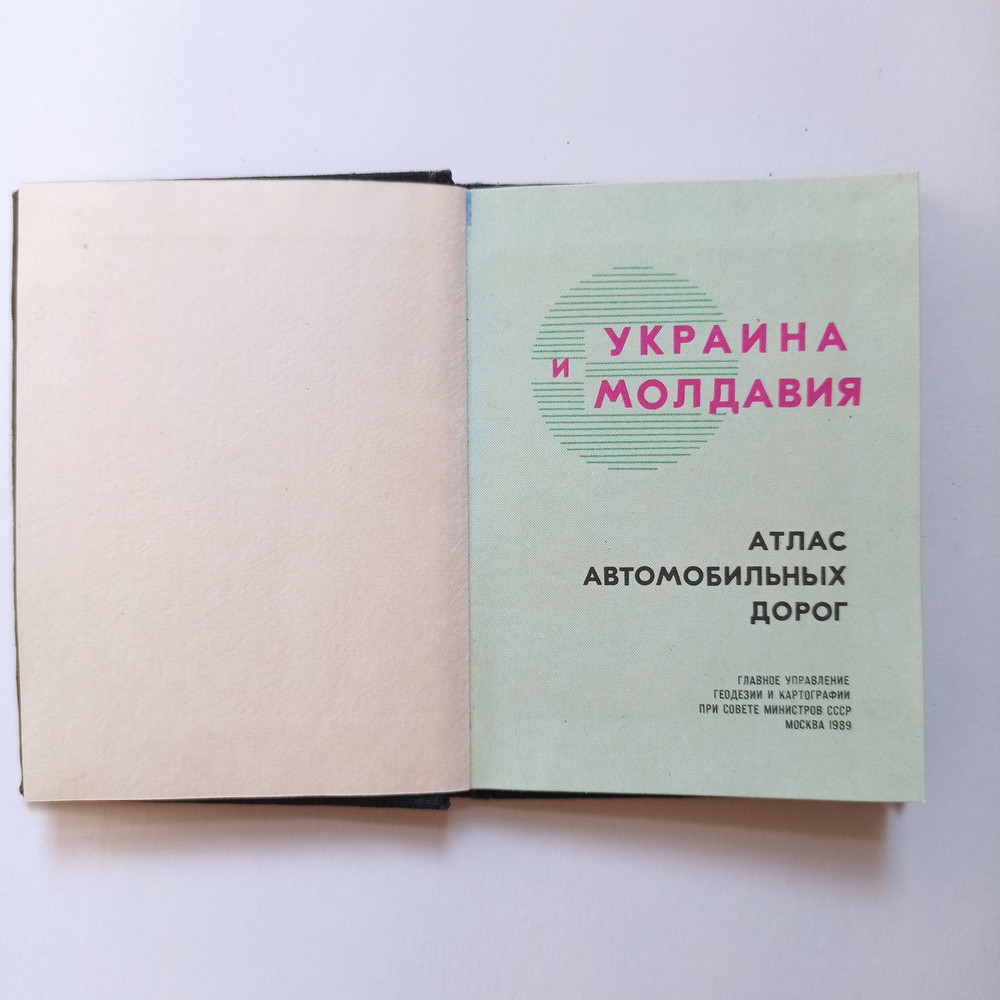
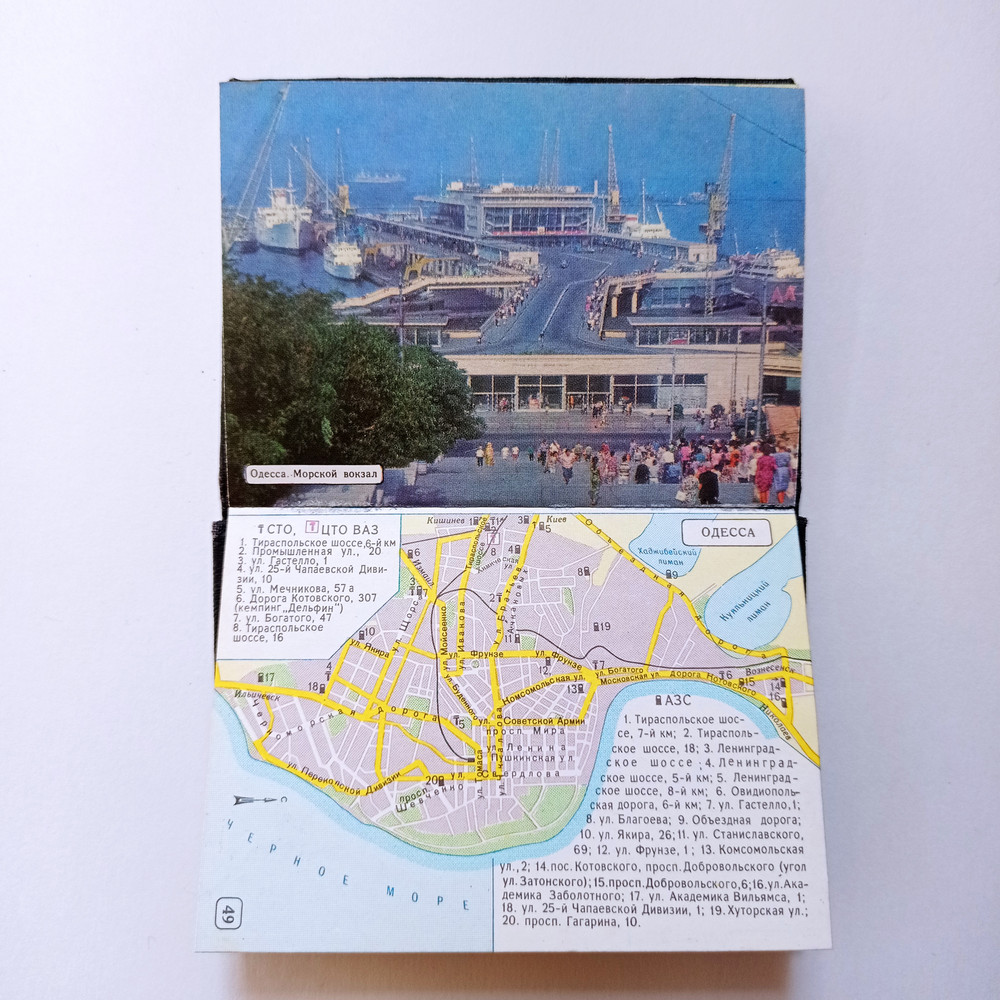
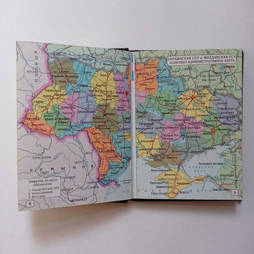
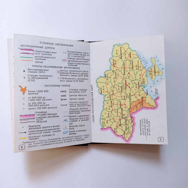
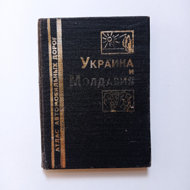
This is an original atlas of highways of Ukraine and Moldova, published by the Main Directorate of Geodesy Cartography under the Council of Ministers of the USSR in Moscow in 1989. The atlas measures 7.5 by 10 centimeters in size and has a thickness of 0.8 centimeters (2.95*3.94*0.31 in). It contains detailed maps of the highways and roads of Ukraine and Moldova, providing valuable information for travelers and researchers alike. This item is a rare and unique piece of Soviet-era cartography, and would make a great addition to any collection of historical maps or geographic memorabilia.
Language: Russian.
Due to the color rendering features of the monitor, the color may vary slightly.
Cancellation of the order is possible within 1 day, before the shipment of the goods. The order is processed within 1-3 business days. Delivery by Russian Post (14-60 days). I will provide a tracking track. The return of the goods is not possible. If you have any questions, please contact me.
Free Shipping
24/7 Live Chat
Secure Payments